


By Ann Wavinya
In July, a series of ecosystem restoration workshops were held in Kenya, organized at both national and county levels, to advance monitoring and reporting efforts. These workshops brought together key stakeholders to enhance cross-sectoral and multi-scale monitoring frameworks for tracking progress on restoration initiatives.
These events formed part of the Center for International Forestry Research and the International Centre for Research in Agroforestry (CIFOR-ICRAF), Delivering Nature-based Solution Outcomes by addressing Policy, Institutional and Monitoring gaps in Forest and Landscape Restoration project funded by the Partnering for Accelerated Climate Transitions programme (UK PACT), which focuses on addressing gaps in policy, institutional frameworks and monitoring practices for Forest and Landscape Restoration (FLR). The goal is to build capacity for more effective FLR implementation and improve coordination and learning between farm, county, and national scales.
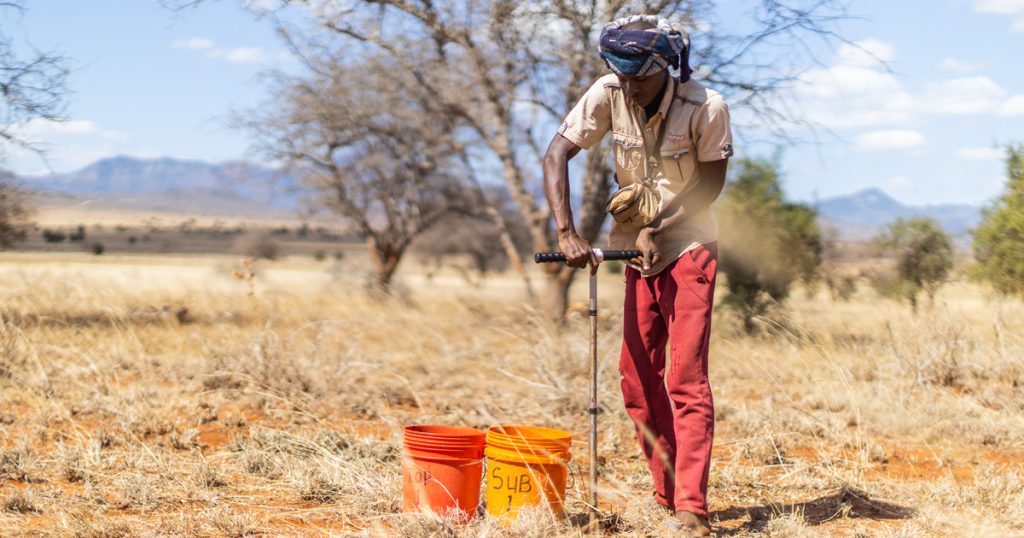
One component of the project involves data collection using tools like the Land Degradation and Surveillance Framework (LDSF) and the Regreening App. The goal is to leverage these data collection and analysis efforts to improve restoration practices. According to Mieke Bourne, CIFOR-ICRAF’s lead for Regreening Africa and co-lead for the Knowledge for Great Green Wall Action, who also oversees stakeholder engagement and evidence integration, “monitoring restoration at both national and county levels is important for tracking and reporting progress, highlighting successes, learning from the challenges and refining interventions to benefit communities.
“Monitoring strengthens the connections between county and national levels, ensuring a comprehensive view of restoration progress,” Bourne emphasizes. “Collaboration is essential for a lasting success.”
National workshop
The workshops began with a one-day national-level session held on July 15 in collaboration with Kenya’s Ministry of Environment, Climate Change and Forestry and the Monitoring Technical Working Group. The workshop focused on national-level data use and gaps.
In his remarks, Peter Minang, Director for Africa at CIFOR-ICRAF, highlighted the significance of data quantity, quality and accessibility.“Monitoring is one of the biggest challenges in restoration efforts across Africa and this project is helping to bridge that gap,” notes Minang.
Leigh Winowiecki, CIFOR-ICRAF’s Soil and Land Health Theme leader and the project’s principal investigator, echoed these views, stressing the critical role of data in nature-based solutions.
“This requires a paradigm shift in how we implement, engage and generate the much-needed evidence to influence policy and practice,” says Winowiecki. “It also means working across the entire landscape.”
In line with the meeting objectives, participants reviewed the country’s existing restoration monitoring frameworks, discussed and agreed on options and steps to operationalize the monitoring and reporting system and identified platforms for data reporting, analysis and access. They also pinpointed gaps and needs, agreeing on steps to link national-level reporting with counties. Gender inclusion, aquatic and biodiversity indicators were examined for integration into the monitoring framework.
During the workshop, Kenya Forestry Research Institute and CIFOR-ICRAF demonstrated the Regreening App and Jaza Miti App, respectively. Participants engaged with both tools, offering feedback on potential improvements and synergies. These apps serve as the primary platforms in Kenya for collecting restoration data.

County workshops
From 22-25 July, additional workshops were held in Taita-Taveta and Makueni counties, focusing on data use, monitoring and reporting.
The workshops aimed to identify use cases and application opportunities for monitoring data collected via the Regreening App, LDSF and other sources while reviewing the Kenya Forest and Landscape Restoration Monitoring Framework. Discussions centred on how data could be collected, analysed, evaluated and accessed by a diverse range of stakeholders. The national ecosystem restoration monitoring framework was also revisited, with participants exploring opportunities for country-level reporting.
Participants, including national agencies, county governments, civil society and community representatives, examined current restoration data and addressed challenges in data collection and access. They also explored strategies for using this data to inform evidence-based policies and strengthen coordinating restoration monitoring between the national and county levels.
Importance of data in monitoring restoration
Kenya has pledged to restore 5.1 million hectares of degraded land by 2030, with a goal of increasing forest and tree cover to at least 30% of the country’s land by 2050 under the African Forest Landscapes Restoration Initiative (AFR100). Key efforts, like the ambitious 15 billion trees initiative, are mobilising resources towards these targets. However, as highlighted during recent workshops, the lack of efficient systems for data acquisition, storage, and dissemination poses a challenge for effective restoration.
To tackle data gaps and enhance information-sharing between national and country-level agencies, workshop participants engaged with interactive data walls, followed by group discussions. These data walls, featuring information on soil health maps, gender dynamics, water filtration data, tree cover, grass data and many others, provided a comprehensive picture of local conditions and helped identify evidence-based policy solutions.
Joseph Muema, Makueni’s member of the County Assembly and chair of the Environment, Climate Change and Natural Resources County Committee, stressed the importance of restoration data, stating: “Data minimises resource wastage, boosts efficiency, and informs policymaking. Coordinated monitoring at both national and county levels is crucial for achieving our goals and reducing duplication.”
Further, emphasizing community-level impacts, Mwajuma Karim, vice chair of Mahoo Ward’s Climate Change Planning Committee and Taita-Taveta county’s community member: “Data is the proof of impact. It ensures that resources are used effectively and helps communities decide on the best restoration strategies.”
“This facilitates the community in deciding which restoration approaches to use,” explained Karim.
Going forward, CIFOR-ICRAF aims to synthesise insights from these dialogues and advance data coordination and reporting mechanisms. Plans include deeper engagements with county officials and the national Monitoring Technical Working Group to enhance the restoration agenda at all governance levels.
Read more:
- From national targets to grassroots transformation
- Taking root in Kenya: Nature-based climate solutions project kicks off
For more information, please contacts:
- Mieke Bourne, m.bourne@cifor-icraf.org
- Leigh Ann Winowiecki, l.a.winowiecki@cifor-icraf.org